GEOTECHNICAL ENGINEERING
STOKE-ON-TRENT
HomeGeophysicsElectrical resistivity / VES (Vertical Electrical Sounding)

Electrical resistivity surveys in Stoke-on-Trent: mapping ground conditions with VES

Practical geotechnics, field-tested.

LEARN MORE

Ignoring hidden voids in former coal mining areas is the most expensive mistake a developer in Stoke-on-Trent can make. The city sits on the North Staffordshire Coalfield, where unrecorded shafts, bell pits, and backfilled marl workings riddle the shallow subsurface. A standard borehole gives you a single point. It can miss a 2-metre void sitting two metres to the left. Vertical electrical sounding maps resistivity contrasts across a wider profile and picks up the air-filled or water-filled cavities that traditional drilling skips. We run VES arrays across brownfield sites in Hanley, Longton, and Burslem before the first excavator arrives, often pairing the survey with test pits to calibrate resistivity anomalies against exposed strata. The result is a ground model that accounts for the mining legacy, not just the soil type.

A VES line across a Stoke-on-Trent brownfield can reveal a bell pit that no historical map recorded—and save the piling contractor a very expensive surprise.
Our service areas

Methodology and scope

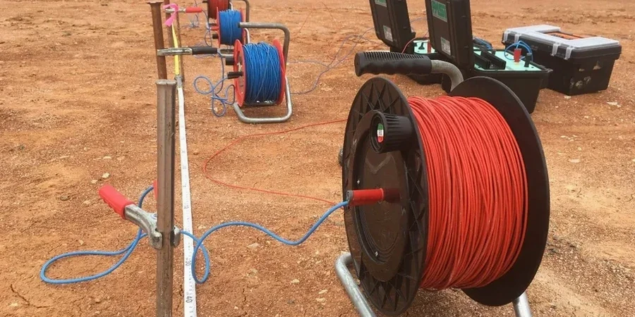
The field setup uses a 4-electrode Schlumberger array powered by a 250 W DC transmitter, with stainless steel stakes driven into the glacial till and brickearth that cap most of the Potteries. Current electrodes are spaced progressively wider—from 1.5 m up to 100 m—to push the investigation depth past 30 metres, which is where many of the deeper mine workings and sandstone-mudstone contacts sit. Apparent resistivity readings are logged every metre of expansion and inverted with RES2DINV to produce a 2D pseudosection. On sites near the Trent & Mersey Canal or along the Fowlea Brook corridor, we often counter-check low-resistivity zones with CPT testing to separate water-saturated clays from leachate plumes. The equipment is ruggedised for the damp, often windy conditions typical of the Staffordshire uplands, and the entire acquisition sequence on a standard residential plot takes under three hours.
Electrical resistivity surveys in Stoke-on-Trent: mapping ground conditions with VES
Technical reference — Stoke-on-Trent

Local geotechnical context

Ground conditions change abruptly across the city. The Etruria Formation marls underlying Hanley and Burslem weather to stiff clay but contain bands of sandstone that channel groundwater unpredictably. Over in Longton, the Middle Coal Measures produce acidic mine water that corrodes buried concrete and steel. A VES survey differentiates these units by their resistivity signature: intact marl runs below 30 Ω·m, water-filled workings dip under 10 Ω·m, and air-filled cavities spike above 200 Ω·m. Without this contrast, a geotechnical investigation can misclassify a perched water table as regional groundwater or mistake a collapsed shaft for natural soft ground. On one Longton site, our VES line identified a 4-metre-wide low-resistivity anomaly at 8 metres depth that turned out to be a flooded roadway from the 1890s—exactly where the client had planned the lift shaft. The foundation layout was shifted by six metres and the project stayed on programme.

Need a geotechnical assessment?

Reply within 24h.

Email: info@geotechnical-engineering.biz

Reference standards

BS 5930:2015+A1:2020 – Code of practice for ground investigations, BS EN 1997-2:2007 (Eurocode 7 Part 2) – Ground investigation and testing, BS 10175:2011+A2:2017 – Investigation of potentially contaminated sites, ASTM D6431-18 – Standard guide for using the DC resistivity method (international reference)

Technical data

ParameterTypical value
Array configurationSchlumberger (standard); Wenner optional for lateral resolution
Max investigation depth35–40 m with AB/2 = 100 m, depending on overburden conductivity
Current source250 W DC transmitter, auto-ranging up to 800 V
Electrode typeStainless steel stakes, salt-water coupling in high-resistivity made ground
Data inversionRES2DINV smoothness-constrained least-squares; RMS error typically <5%
Reporting standardBS 5930:2015+A1:2020, Eurocode 7 (BS EN 1997-2:2007)
Typical survey duration (residential plot)2–3 hours acquisition plus 1–2 days processing
Output deliverables2D resistivity pseudosections, interpreted geological cross-sections, anomaly register

Frequently asked questions

How much does a VES survey cost for a typical residential plot in Stoke-on-Trent?

For a standard residential plot in the ST1–ST6 postcode area, a VES survey with two to three sounding points and a full interpretive report falls in the range of £560 to £940, depending on access constraints and the required depth of investigation.

Can resistivity surveys tell the difference between a water-filled void and natural clay?

In most cases, yes. Water-filled voids in the Coal Measures typically show resistivity below 10 Ω·m, whereas intact Etruria Marl or glacial till runs between 20 and 40 Ω·m. We calibrate the interpretation against any available borehole logs or trial pit data to reduce ambiguity.

How long does it take to get results from a resistivity survey in Stoke-on-Trent?

Fieldwork on a standard plot takes about two to three hours. Data processing and inversion are completed within one to two working days, and the final report is delivered within three to five working days of the site visit.

Location and service area

We serve projects in Stoke-on-Trent and surrounding areas. More info.

View larger map