GEOTECHNICAL ENGINEERING
STOKE-ON-TRENT
HomeSlopes & WallsRetaining wall design

Retaining Wall Design in Stoke-on-Trent: Geotechnical Stability for the Potteries

Practical geotechnics, field-tested.

LEARN MORE

In Stoke-on-Trent, retaining wall design often starts with the question of what lies beneath the surface. The city's six towns sit on a patchwork of glacial till, weathered shale, and former colliery backfill that varies dramatically across short distances. More than 300 abandoned mine shafts are documented across the Potteries area, and many more remain unrecorded. A retaining wall here cannot rely on textbook assumptions. Our design approach integrates desk study of Coal Authority records with physical ground investigation to map the interface between competent rock and fill. For sites near the canal corridors, we routinely combine wall design with slope stability analysis to account for saturated groundwater conditions, and when wall loads are high we specify anchor systems tested to BS 8081:2015 for long-term corrosion protection in Stoke-on-Trent's variable soil chemistry.

In Stoke-on-Trent, a retaining wall's success depends less on the concrete mix and more on understanding the groundwater regime behind it.

Our service areas

Methodology and scope

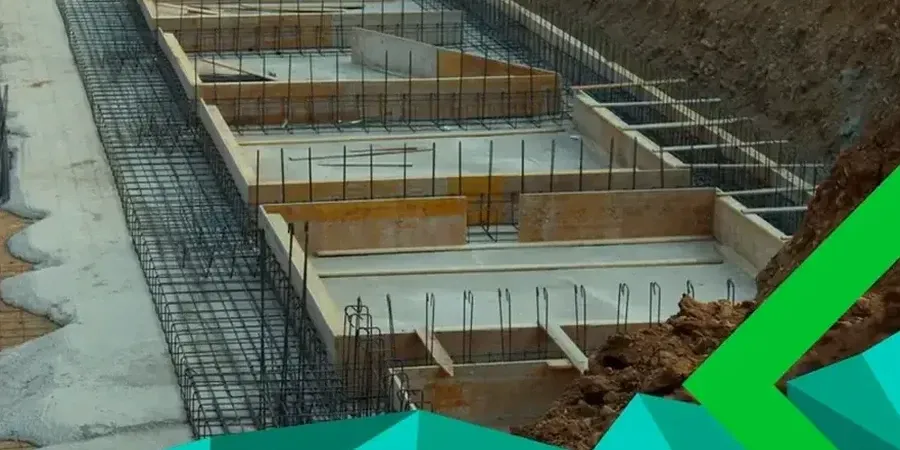
A developer in Hanley approached us with a 4.5-metre cut at the rear of a proposed residential block, directly adjacent to a Victorian-era retaining wall of uncertain foundation depth. Site investigation revealed medium-dense sandy gravel over highly weathered Etruria Marl. The challenge was not just retaining the new cut but ensuring the existing wall would not be undermined during excavation. We specified a reinforced concrete cantilever wall with a 1.2-metre key to engage the marl, verified through a drained effective stress analysis per BS EN 1997-1:2004. Groundwater monitoring over six months showed perched water tables after heavy rainfall, so the design included a granular drainage blanket and 100 mm diameter weep holes at 1.5-metre centres. Backfill compaction to 95% relative density was confirmed by proctor tests on the selected Class 6N granular fill, ensuring minimal lateral pressure on the wall stem. The overall design achieved a factor of safety of 1.35 for sliding and 1.5 for overturning under the Design Approach 1 Combination 2 load case.
Retaining Wall Design in Stoke-on-Trent: Geotechnical Stability for the Potteries
Technical reference — Stoke-on-Trent

Local geotechnical context

Stoke-on-Trent's industrial past shapes its present-day geotechnical risk. The city expanded rapidly during the 19th century, with terraced housing built on steep valley sides and extensive coal mining beneath. Historical maps show brickworks, marl pits, and ironstone workings scattered across the six towns, leaving a legacy of unconsolidated fill that can settle unpredictably under wall loading. A retaining wall founded on such material may experience differential settlement leading to cracking, rotation, or drainage failure. The Coal Authority's development high-risk areas cover significant portions of Stoke-on-Trent, requiring a mandatory mining report and often intrusive investigation to locate shallow workings. Without proper design, a wall can become a long-term liability rather than an asset. We address this through staged investigation: desk study, trial pitting, rotary drilling to prove rockhead, and laboratory classification of fill materials. Each step reduces uncertainty and allows the wall geometry, reinforcement, and drainage to be tuned to the actual ground conditions encountered.

Need a geotechnical assessment?

Reply within 24h.

Email: info@geotechnical-engineering.biz

Reference standards

BS EN 1997-1:2004 (Eurocode 7: Geotechnical design), BS 8002:2015 (Code of practice for earth retaining structures), BS 8081:2015 (Ground anchorages), BS 5930:2015 (Site investigation), BS 8500-1:2023 (Concrete specification)

Technical data

ParameterTypical value
Design standardBS EN 1997-1:2004 (Eurocode 7)
Material factor (φ' design)tan⁻¹(tan φ'k / 1.25)
Partial factor (permanent action)γG = 1.35 (DA1-C2)
Minimum FoS sliding≥ 1.0 (ULS) per DA1-C2
Backfill specificationClass 6N / 6P granular per SHW Series 600
Drainage typeGranular blanket + weep holes or carrier drains
Ground investigation depth≥ 1.5 × retained height below base

Frequently asked questions

What regulations govern retaining wall design in Stoke-on-Trent?

Retaining wall design must comply with Building Regulations 2010 (Approved Document A), BS EN 1997-1:2004 (Eurocode 7), and BS 8002:2015. In Stoke-on-Trent, the Coal Authority's permitting process also applies if the site falls within a Development High Risk Area. The local authority's building control team will typically require a full geotechnical design report, including ground investigation data and stability calculations, before approving construction.

How much does retaining wall design cost for a typical project in Stoke-on-Trent?

For a standard residential retaining wall in Stoke-on-Trent, design fees range from £730 to £3,130 depending on wall height, ground complexity, and whether mining risk assessment is required. A simple 1.5-metre garden wall on competent ground falls at the lower end. A 4-metre reinforced wall in a Coal Authority high-risk area, requiring rotary boreholes and detailed stability analysis, falls at the upper end. All fees include the design calculation package and construction drawings.

How do you handle mine workings beneath a retaining wall in the Potteries?

We begin with a Coal Authority mining report and historical map review to identify recorded shafts and seams. If the wall footprint intersects a potential working, we specify rotary open-hole drilling to prove rockhead and detect voids. Depending on depth and condition, we may recommend drilling and grouting to stabilise the workings before wall construction. The wall foundation is then designed to span or bypass the treated zone, with reinforcement detailed to accommodate residual settlement.

Location and service area

We serve projects in Stoke-on-Trent and surrounding areas.

View larger map